
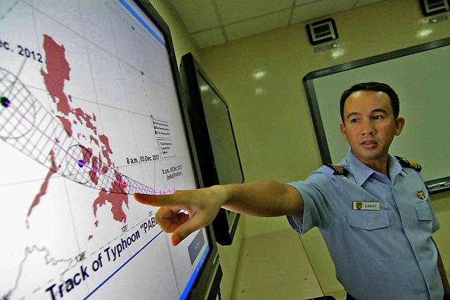
Lt. Col. Dennis Labay, chief of the Coast Guard's operations center, tells the media on Monday the PCG remains on alert as it monitors seaports to make sure no vessels will sail in areas expected to be hit by Typhoon Pablo. Danny Pata
Typhoon Pablo (Bopha) accelerated Monday afternoon and threatened to make landfall before dawn Tuesday in the Davao Oriental and Surigao del Sur area, state weather forecasters said Monday afternoon.
PAGASA forecaster Jori Loiz said the change in Typhoon Pablo's speed may mean landfall between 4 and 5 a.m. Tuesday.
"Maaring mas maaga ang landfall, sa madaling araw," Loiz said in an interview on dzBB radio.
As of 4 p.m., PAGASA said Typhoon Pablo was estimated at 390 km southeast of Hinatuan, Surigao del Sur, with maximum sustained winds of 175 kph near the center and gustiness of up to 210 kph.
PAGASA said Typhoon Pablo is forecast to move west-northwest at 26 kph and is expected to be in the vicinity of Cagayan de Oro City by Tuesday afternoon.
By Wednesday afternoon, it is expected to be 110 km southwest of Iloilo City and at 330 km West of Calapan City, Oriental Mindoro by Thursday afternoon.
Storm signals
As of Monday late afternoon, 10 areas were under Storm Signal 3:
- Surigao del Norte including Siargao Islands
- Surigao del Sur
- Dinagat Province
- Agusan del Norte
- Agusan del Sur
- Misamis Oriental
- Bukidnon
- Davao Oriental
- Compostela Valley
- Davao del Norte including Samal Island
Areas under Storm Signal No. 3 should expect 101-185 kph winds within at least 18 hours.
Under Storm Signal No. 2 are:
- Southern Leyte
- Bohol
- Southern Cebu
- Negros Oriental
- Siquijor
- Misamis Occidental
- Lanao del Norte
- Lanao del Sur
- North Cotabato
- Zamboanga del Norte
Areas under Signal Number 2 should expect 60 to 100 kph in at least 24 hours.
Under Storm Signal No. 1 are:
- Northern Palawan including Calamian Group Of Islands and Cuyo Island
- Eastern Samar
- Western Samar
- Leyte including Biliran
- Aklan
- Capiz
- Antique
- Iloilo
- Guimaras
- Negros Occidental
- Rest of Cebu including Camotes Island
- Zamboanga del Sur
- Maguindanao
- Sultan Kudarat
- Sarangani
- South Cotabato
These places should expect winds of 30 to 60 kph in at least 36 hours, with possibility of intermittent rains.
PAGASA said Typhoon Pablo may bring rainfall of 15 to 30 mm per hour (heavy to intense) within its 600-km diameter. It advised residents in low-lying and mountainous areas under storm signals against possible flash floods and landslides.
It also warned those living in coastal areas under public storm signals 3 and 2 to be alert against big waves or storm surges.
Fishing boats and other small seacrafts were also advised not to venture out into the eastern Seaboards of Visayas and Mindanao.
Canada, UK advise nationals in PHL to take precautions
As this developed, Canada and the United Kingdom advised their nationals in the Philippines to take precautions against bad weather conditions brought by Typhoon Pablo.
In an update to its travel advice, the Canadian government said the typhoon had been forecast to make landfall over the eastern part of the Philippines by Tuesday.
“Typhoon Bopha is expected to make landfall on the eastern islands of the Philippines as a Category 3 typhoon, late on Monday, 3 December (Tuesday, 4 December, local time). Exercise caution, monitor local news and weather forecasts, and follow the advice of local authorities,” it said.
It pointed out that while the typhoon season in the Philippines extends from May to December, cyclones can occur throughout the year.
Such cyclones can result in “significant loss of life and extensive damage to infrastructure, and can hamper the provision of essential services,” it added.
“Keep informed of regional weather forecasts, avoid disaster areas and follow the advice of local authorities,” it advised.
The United Kingdom's Foreign and Commonwealth Office issued a similar advice to its nationals, urging them to take precautions.
"The regions most affected are expected to be Mindanao and the Visayas. We advise British nationals in the affected areas to exercise caution during the passage of the storm and to monitor local news and weather forecasts, and follow the advice of the local authorities," it said.
Typhoon Pablo entered the Philippine Area of Responsibility on Sunday night.
The National Disaster Risk Reduction and Management Council went on red alert Monday for possible effects of Typhoon Pablo. — with Shai Panela/KBK, GMA News
0 comments:
Post a Comment